Las Cruces offers access to both everyday walking paths and rugged hiking trails within minutes of town. With more than 300 days of sunshine each year, residents and visitors can choose between paved routes for daily exercise or mountain trails that climb into the Organ Mountains and surrounding desert.
Understanding the difference between these two kinds of trails matters. Walking paths in Las Cruces are designed for routine movement, accessibility, and short outings, while hiking trails outside the city include elevation gain, uneven terrain, and require greater preparation. Both play a key role in outdoor recreation and quality of life in Southern New Mexico.
Maintaining that quality of life often requires a local partner. Mesilla Valley Pharmacy supports the community’s active lifestyle by offering expert advice on everything from everyday medications to wellness supplements. Founded by pharmacists who prioritize small-town service, they help residents stay healthy enough to enjoy every mile. Stop by Mesilla Valley Pharmacy today to speak with a pharmacist about optimizing your health regimen before your next adventure.
What Is the Difference Between Walking Trails and Hiking Trails in Las Cruces?
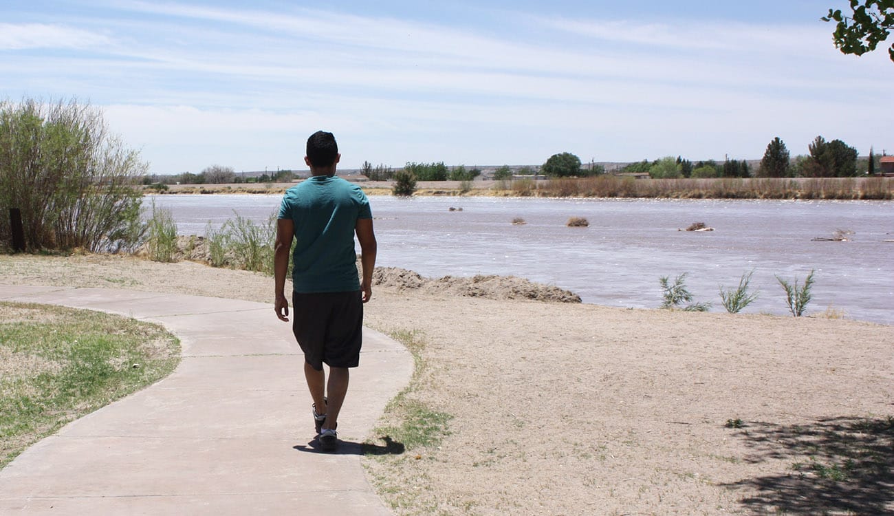
Walking trails in Las Cruces are typically paved or smoothly graded paths located within the city or along the Rio Grande. These routes are built for regular use and may include lighting, benches, restrooms, and distance markers. Many are suitable for wheelchairs, strollers, and leashed dogs.
Hiking trails near Las Cruces are usually unpaved and found in the Organ Mountains and surrounding desert areas. These routes include elevation gain, rocky or sandy surfaces, limited shade, and longer distances. Hikers should plan ahead with water, sun protection, appropriate footwear, and awareness of weather conditions.
City Walking Trails and Paved Paths in Las Cruces

Las Cruces maintains a strong network of city walking paths that support daily exercise and neighborhood access. These trails are commonly used for walking, jogging, and casual outings and are among the most accessible outdoor options in the area.
Apodaca Park Walking Loop
Apodaca Park features a paved walking loop of about 0.6 miles. The route is wheelchair-accessible and is commonly used for walking and jogging. Other park amenities include tennis and pickleball courts, open fields, playgrounds, benches, picnic tables, water fountains, and restrooms.
La Llorona Park and Multi-Use Path
La Llorona Park connects to a paved multi-use path that runs roughly three miles along the Rio Grande. The trail is flat, marked with distance indicators, and links with other city paths. Picnic tables, restrooms, and playgrounds are located in the park, and leashed dogs are allowed. Benches along the path make it suitable for longer walks.
Triviz Trail
The Triviz Trail is a paved urban path stretching about 4.6 miles through areas of Las Cruces. It connects residential areas, commercial centers, and parts of the New Mexico State University area. Much of the trail is wheelchair-accessible and well-lit, and it connects to other routes.
Alameda Arroyo Trail
Alameda Arroyo Trail is a shorter walking route of about 0.75 miles near Roadrunner Parkway. It includes a paved section with an adjacent dirt path and features open desert scenery. The trail is wheelchair-accessible and is often used for brief neighborhood walks.
Desert Trails Community Park
Desert Trails Park spans approximately 34 acres and includes both paved and natural-surface paths. The trails wind through preserved desert landscape and offer a quieter walking experience. Amenities include parking and water fountains with dog bowls.
Beginner-Friendly Walking Paths and Family Routes
Easy walking paths in Las Cruces are well-suited for beginners, families, and anyone looking for low-impact exercise. These routes are typically flat, paved, and clearly marked, making them ideal for short walks and regular routines.
In addition to Apodaca Park and La Llorona Park, several beginner-friendly paths run near Roadrunner Parkway, including trails beyond Sagecrest Park and Veterans’ Park. These connected segments offer smooth surfaces, open views, and quiet surroundings, and are commonly used for neighborhood walks, stroller use, birding, and casual exercise.
Desert Trails Community Park also offers gentle walking routes through a natural desert setting, while sections of the Triviz Trail are well-suited for beginners seeking longer, still accessible paths.
For first-time walkers, early morning and late afternoon are the most comfortable times, especially during warmer months. Water, sun protection, and supportive footwear remain essential, even on short, paved walks.
Scenic Hiking Trails Near Las Cruces
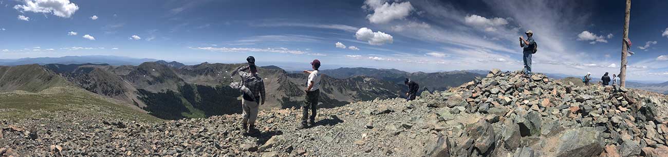
Beyond the city, scenic hiking trails climb into the Organ Mountains and the surrounding desert. These routes offer expansive views and a more immersive outdoor experience, but require greater preparation than city walking paths.
Pine Tree Trail
Pine Tree Trail is a moderate 4.5-mile loop hike in the Organ Mountains at Aguirre Spring Natural Area with steady elevation gain and broad views of the Mesilla Valley. The trail is popular with hikers looking to build endurance and experience high-desert terrain.
Baylor Pass Trail
Baylor Pass Trail follows a historic route connecting the east and west sides of the Organ Mountains. The trail links to Aguirre Spring and offers long-distance hiking options through rugged mountain terrain.
Dripping Springs Trail
Dripping Springs Trail is one of the more accessible hiking routes in the Organ Mountains. The trail leads to the historic ruins of an early-20th-century sanatorium and offers birdwatching opportunities. It’s one of several trails at Dripping Springs Natural Area, managed by the BLM.
Sierra Vista Trail
Sierra Vista Trail runs along the foothills of the Organ Mountains and offers extended views and a quieter setting. It is longer and more remote than many city-accessible routes and is best suited for experienced hikers. It is also popular with mountain bikers.
Tortugas Mountain or “A” Mountain Trail
Located near New Mexico State University, Tortugas Mountain offers a short but steep hike with a clear view of Las Cruces. The trail is commonly used for quick outings and sunrise or sunset hikes.
Picacho Peak and Box Canyon Loop
This loop circles one of Las Cruces’ most recognizable landmarks, Picacho Peak. The terrain is moderately challenging, with desert scenery and rock formations throughout the route.
| Trail | Approximate Length | Trailhead / Location |
| Pine Tree Trail |
|
|
| Baylor Pass Trail |
|
|
| Dripping Springs Trail |
|
|
| Sierra Vista Trail |
|
|
| Tortugas Mountain / “A” Mountain Trail |
|
|
| Picacho Peak / Box Canyon Loop |
|
|
Moderate and Challenging Hiking Trails in the Organ Mountains
Moderate and challenging hikes near Las Cruces often involve sustained elevation gain, rocky surfaces, and limited shade. Trails such as Pine Tree, Baylor Pass, and Sierra Vista offer panoramic views but require careful planning.
Hikers should carry sufficient water, wear sun protection, and monitor weather conditions. Summer heat and sudden changes in wind or temperature can significantly affect trail conditions. Rescues are not uncommon in the more rugged part of the Organ Mountains, so make sure you’re prepared before you tackle strenuous trails.
Tackling these rugged trails requires a body that is functioning at its best, and that starts with reliable healthcare. Mesilla Valley Pharmacy goes beyond a typical drugstore experience by offering specialized compounding, medication management, and clinical advice. Their pharmacists provide the personalized medical support you need to manage your health conditions effectively, ensuring you are physically prepared for the trail ahead.
Historic and Educational Trails Around Las Cruces
Several hiking areas near Las Cruces combine outdoor activity with education and history. Dripping Springs Trail includes interpretive information about the area’s sanatorium history and early use of the site.
In addition to self-guided experiences, educational walks are occasionally offered in the Organ Mountains–Desert Peaks National Monument and in the Picacho Hills area. These guided walks often focus on geology, ecology, cultural history, and land stewardship, providing a deeper context for the landscape.
Wildlife Viewing and Nature Walks in Las Cruces
Wildlife viewing opportunities vary by trail type. Walking trails near the Rio Grande, especially at Mesilla Valley Bosque State Park and Leasburg Dam State Park, are popular for birdwatching and observing seasonal wildlife. The trails behind the Las Cruces Dam and Dripping Springs are also productive areas for birders.
Mountain and desert hiking trails offer opportunities to see native plants, reptiles, and birds adapted to arid environments. Spring wildflowers and fall migration seasons are especially active times for nature observation.
Community Tips and Local Trail Resources
The Las Cruces hiking and walking community is active and well supported by local organizations. Trail maps and condition updates are available through city resources and regional trail groups.
The Southern New Mexico Trail Alliance provides information on trail use and maintenance across the region. Local advice often emphasizes starting early, avoiding peak heat, and choosing routes that match experience level.
The Mesilla Valley Audubon Society offers several free guided bird walks each month at a variety of popular trails.
Choose the Right Trail for Your Day
Las Cruces offers a rare combination of accessible city walking paths and challenging hiking trails just outside town. Whether the goal is daily exercise, wildlife viewing, or mountain exploration, the area provides options for every pace and ability.
Choose the trail that fits your plans, prepare for the conditions, and take time to explore both the urban paths and the surrounding desert and mountains.
When your hike is done, remember that consistency is key to long-term health and wellness. Mesilla Valley Pharmacy is there to support your ongoing health goals with compounding services, supplement guidance, and a pharmacy experience rooted in genuine care. Visit them today to transfer your prescriptions and experience the difference of a pharmacy that puts you first.
FAQs
What are the best walking paths in Las Cruces for everyday exercise?
City walking paths such as Apodaca Park, La Llorona Trail, and the Triviz Trail are ideal for everyday exercise. These routes are paved, accessible, and located within the city, making them suitable for regular walking, jogging, and casual outings.
Are walking trails and hiking trails the same in Las Cruces?
No. Walking trails in Las Cruces are typically paved city paths designed for accessibility and daily use. Hiking trails in the Organ Mountains and surrounding desert are unpaved routes that involve elevation gain, uneven terrain, and require greater preparation.
Which hiking trails near Las Cruces are suitable for beginners?
Dripping Springs Trail and Mesilla Valley Bosque State Park Trails are often recommended for beginners. These hikes are relatively short and well-defined, though hikers should still bring water and sun protection.
Where can I go birdwatching on walking trails in Las Cruces?
Mesilla Valley Bosque State Park is one of the best locations for birdwatching while walking. Its riverside paths attract migratory birds, waterfowl, and native species year-round. The paved trail system beyond Sagecrest Park that connects to Veterans Park east of the Las Cruces Dam is also good for birding.
Are there guided or educational hikes near Las Cruces?
Yes. Educational walks are sometimes offered in the Organ Mountains–Desert Peaks National Monument and in the Picacho Hills area. These walks often focus on natural history, geology, and ecology. The Mesilla Valley Audubon Society offers guided bird walks several times a month.
Story sponsored by Mesilla Valley Pharmacy

Visit the Website
Posted by LasCruces.com