Silver City in southwest New Mexico is an outdoor lover’s paradise, tucked into the mountains on the edge of the Gila National Forest and near the Gila and Aldo Leopold Wilderness Areas. Whether you’re into hiking, road biking, mountain biking, birding, camping, history, or just visiting someplace new, you can find something exciting to experience here.
Silver City is the county seat of Grant County, which stretches from south of I-10 north to just below the Catwalk Recreation Area, to the Arizona border on the west, and almost to Kingston on State Highway 152 to the east. The county encompasses a whopping 3,968 square miles. In other words, it covers a lot of ground and has much to offer . . . more than we’ll be able to include here! We’ll focus on some of the many outdoor adventures you can enjoy with Silver City as a base. Let’s envision this experience as a series of branches on a tree, with downtown Silver City as the trunk. Let’s get started!
SILVER CITY: Your Home Base

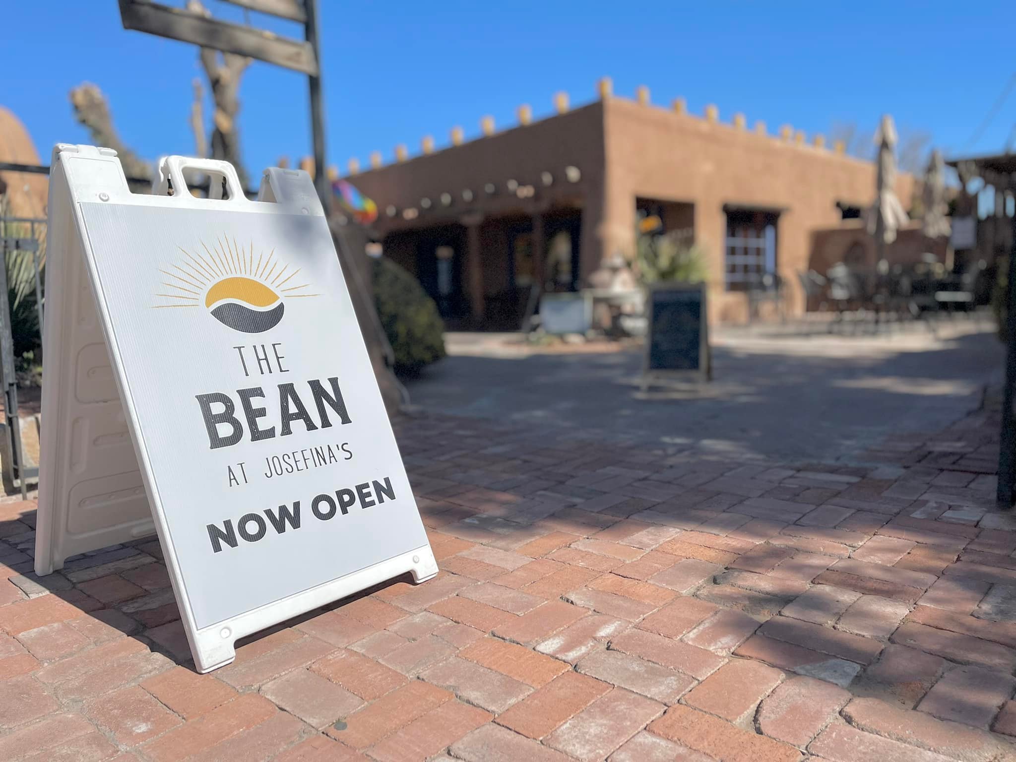
This mining town is a great place to use as a hub for lodging, dining, and exploring the wealth of art galleries and unique shops. You can pop into one of the outdoors-focused shops, like Gila Hike & Bike, to get both tips on hiking and biking trails and any equipment you need. Another place to get your bearings is the Murray Ryan Visitor Center, the town’s official visitor center which offers a helpful staff and lots of resources.
If you’re RV camping and want full hookups, there are several RV parks in Silver City. Otherwise, campers will discover plenty of options on public land for basic developed campsites or dispersed camping. Of course, Silver City has hotels from historic to modern for those wanting a little more comfort after their days of exploration. See our article here about Silver City restaurants, galleries, shops, hotels, and events, like the Silver City Blues Festival which takes place Memorial Day weekend.
Get Outdoors in Silver City
Have you noticed that the sidewalks in Silver City are quite high above street level? That’s in response to flooding during the rainy season, when the water may reach the top of those tall sidewalks.
Big Ditch Park was once Silver City’s main street. When San Vicente Creek flooded in the late 1800s and early 1900s, it carved the land down 55 feet below the original street level. Once used as a dump, the area has now been turned into a creekside park with a walking path and benches. You may find some interesting birds here like striking western tanagers or migrating warblers. You can access it from the Murray Ryan Visitor Center — cross the bridge towards town and head down the steps to the paved path and a mural commemorating the floods that created the Big Ditch.
One of the most popular hiking destinations for those who want to get in a hike without a drive to the forest is Boston Hill. This former mining property is now crisscrossed with a network of hiking and mountain biking trails. With six trailheads positioned around the hill on the edge of town, it’s convenient for a hike. The longest trail loops all around the edge of the hill and is 5.25 miles. Other loops are shorter, from three-quarters of a mile to a mile and a half. The more challenging trails are near the peak’s summit of 6,380 feet (the town’s elevation is 5,895 feet). You’ll go by several former mining sites and pits along your way, showing just how important mining was to Silver City’s history (there’s a reason it has that name!).
Owners of Animalia Studio, Karen Pritchett and Todd Shelby, say they hike or bike almost every day before or after work. Their go-to hike is Boston Hill, usually accessing it at Spring Street or Cooper Street near the cemetery. Todd says, “We can literally walk out the door and get to a trailhead. They are always improving and creating new trails on Boston Hill. We have some favorite new spots. If you go up Market and turn left on Cheyenne, it takes you up to a whole new trail that they’ve built that has switchbacks and it’s really pretty.”
NM HIGHWAY 15: Pinos Altos and Beyond

Only about six miles from Silver City you’ll find Pinos Altos, a little town rich with history. Today you can visit, when open, the Buckhorn Tavern, Pinos Altos Opera House, a museum and gift shop, and take a peek at a fort that was relocated from Santa Rita in the 1980s and is being restored by Buck Burns, who is one of the owners of Manzanita Ridge in Silver City, and who also recently purchased the Hearst Church in Pinos Altos.
Three miles past Pinos Altos you’ll see a large gravel parking area to your right. Pull over and cross the highway to a short trail that takes you to an interesting monument with a dramatic view. This spot honors Ben Lilly, a prodigious hunter who once guided President Theodore Roosevelt. This religious man was reputed to have killed hundreds of bears and mountain lions before he died in 1936.
To hit the trail, go just a bit further on NM 15 to a spot to your right marked as the Arrastra Interpretive Site. There’s parking for several cars here on a short road just off the highway. The arrastra was a mill used by miners in the 1800s to grind ore to extract gold. You’ll find a reproduction of the mill and panels explaining the process.
Hikers and mountain bikers will discover Continental Divide National Scenic Trail (CDT) medallions attached to trees guiding them onto a segment of the 3,100-mile trail being built from the Mexican border to Canada.
Buck says, “From here, you can go up to the Twin Sisters in the Pinos Altos Range or you can go west and south, which is where I go, because that will tie you into Bear Creek Road, which is a major road in Pinos Altos. You can take the CDT all the way over the mountain range to Little Walnut, which is about five miles. Not only that, but there’s also all these old roads and trails from the old mining camps that used to be in Pinos Altos, and you can see the caverns and caves that they dug.”
Julia Osgood lived in Silver City and advises birders and campers to continue a couple of miles on NM 15 to visit McMillan and Cherry Creek campgrounds, both operated by the Forest Service with free, first-come, first-served camping.
Cherry Creek Campground has 12 developed sites with fire rings and picnic tables. The forest service website touts it as one of the more scenic spots on the Trail of the Mountain Spirits Scenic Byway, which loops for 74 miles along NM State Highways 15, 35, 152, and 180. Julia has spotted red-faced warblers and plumbeous vireos there.
McMillan Campground has three undeveloped tent sites. Tadpole Ridge Trail 232 and Signal Peak Trail 742, ranked as intermediate to difficult, are two miles north of the campground. In addition, Julia says, “There’s a really nice trail at McMillan. You can access the trail from campsite two or three.
As you hike up that trail, especially in the spring, you hit the 7,000-foot mark and high-elevation birds are all around: MacGillivray’s warblers, mountain chickadees, pygmy nuthatches, brown creepers, and of course the red-faced warblers.”
For those looking for a challenge, check out the area further along 15 to Signal Peak, where you may see cordilleran flycatchers along with other birds. Eric Payne of Gila Hike & Bike says, “For most of the year it’s just so good between Signal Peak and Tadpole Ridge to the Black Peak area. It’s up high and very awesome. And the trail, the CDT, is so nice around here. There’s good biking with a long descent that goes down Little Cherry Creek. In fall it’s beautiful with colorful leaves.”
Jay Hemphill, a photographer and avid hiker, adds, “The Signal Peak Trail goes from Highway 15 at Signal Peak all the way to the peak, about 2.5 miles up to the fire tower at the top. It’s steep and gains a couple thousand feet in 2.5 miles.”
Lake Roberts
Take the spur onto NM 35 as you travel north on NM 15 to reach Lake Roberts (or go directly on NM 35 for a less windy route). This is a day-use area with natural beauty galore. The lake is surrounded by the Gila National Forest and offers fishing for rainbow trout and catfish as well as boating for electric motors and non-motorized boats. Eric suggests hiking Purgatory Chasm Trail at Lake Roberts, which he says has a miniature slot canyon and Native American rock art. AllTrails says this hike is 1.6 miles and is moderately challenging with some scrambling and water crossings.
The closest camping is found at Mesa Campground and Upper End Campground. Mesa has views of Lake Roberts and 24 campsites, including 12 sites with water and electric hookups suitable for trailers, picnic tables, drinking water, and heated restrooms with flush toilets. Camping fees are charged. It is first come, first served, and America the Beautiful passes give holders a half-price discount on the fee.
Upper End Campground has 12 campsites, including two that can accommodate self-contained RVs up to 45 feet. Other sites limit RVs to 32 feet. The campground has fire grills, picnic tables, drinking water, and restrooms. Still first come, first served, campsites here are $10 a night.
Gila Cliff Dwellings National Monument
Continuing more than an hour along NM 15 will take you to one of the most popular destinations in Grant County, the Gila Cliff Dwellings National Monument. While the dwellings are only 44 miles from Silver City, this is a windy road that will take 90 to 120 minutes to traverse.
Once there, plan another hour or so for the hike to the dwellings, a moderately difficult one-mile loop. Enjoy the beauty of the Gila National Forest as you hike to the star of the show: cliff-side caves overlooking Cliff Dweller Creek that gave people passing through shelter for thousands of years. For a generation or two, Mogollon people stayed to raise families.
The visitor center has a small museum with Mogollon artifacts. The trailhead and bookstore are two miles away. It is now free to visit the monument. Note that no food or beverages other than water are allowed on the trail to the cliff dwellings and only trained service dogs can hike with you. Kennels are available at no charge for other pets.
If you plan to camp on your visit to the cliff dwellings, four free Forest Service campgrounds are within a 10-minute drive to the park. All are designed for tents rather than RVs, although there are a few sites that can accommodate RVs for dry camping.
Upper Scorpion and Lower Scorpion are less than a mile away and offer water, tables, grills, and pit toilets. Forks Campground is five miles south of the dwellings and offers only primitive camping — so primitive that the only water source is the river, and the only facilities are vault toilets. Grapevine Campground, temporarily closed at press time, is the same and is not recommended for RVs at all due to a tight turn at the entrance.
HIGHWAY 180 South of Silver City
City of Rocks
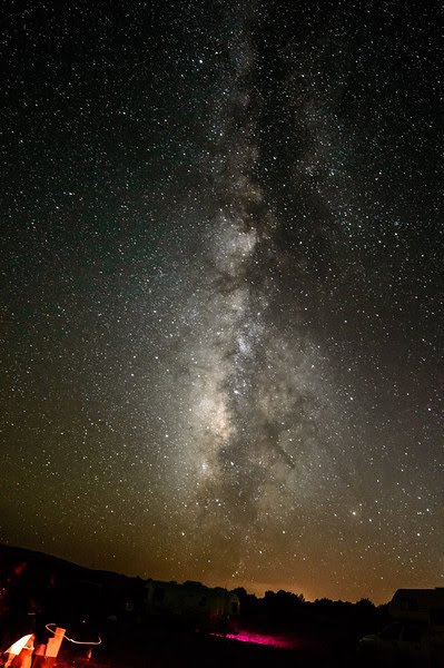
About halfway to Silver City from Deming, you will pass NM 61. Don’t neglect to turn right and go just a few miles to City of Rocks State Park. Here you will find volcanic pinnacles rising to 40 feet above the desert floor. Campsites are tucked among the rocks, providing otherworldly camping with unparalleled night skies.
The park has more than five miles of hiking trails, some full hook-up sites, and numerous tent sites. There are pit toilets around the campground and a bathroom with showers at the visitor center. You may hear so many birds singing in the morning that you resort to using Merlin Bird ID’s sound recording option to figure out what’s there!
Fort Bayard Trail System

Just south of Silver City, you can find historic Fort Bayard where soldiers once marched and now many military personnel are buried in its national cemetery. You can find a wealth of hiking and biking trails in the Fort Bayard Trail System, which are accessible year-round and dry out quickly after rain or snow. Two of the most popular trails are the Dragonfly Loop Trail and the Big Tree Trail, but the system includes 18 trails that connect as far as Black Peak and Twin Sisters.
Jay says, “Mountain bikers can ride about 30 miles of trails. It’s flatter than other area trails and is good for beginning mountain bikers. But all levels of mountain bikers can find enjoyment at a place like Fort Bayard. Horse riders can enjoy these trails, too.” Dragonfly Loop Trail is mostly flat with rolling hills and is highlighted by pictographs left by the Mogollon people, including the namesake dragonfly design.
Big Tree Trail is named for a huge juniper tree you’ll see along the way. Buck recalled his favorite visit to this site on a long-ago summer day at the end of the monsoon season when the rains had allowed fields of sunflowers to grow along the trail. “There were sunflowers that were taller than me. Then coming out to the big tree, it was a sea of yellow when I crested the hill. It was phenomenal!”
Another option is heading into Fort Bayard itself and enjoying the flat roads around the old base. The buildings provide a glimpse into the history of the area. Gay and John Mylius of Las Cruces tackled the Dragonfly Loop Trail with their fat-tire e-bikes but said much of it was too rocky. Instead, they found that riding around Fort Bayard was perfect.
John said, “The buildings were interesting historically. We rode all around and I’d like to go back for the Saturday tour.” Gay added, “It was interesting to try to picture the soldiers marching on the parade grounds. It’s cool.”
HIGHWAY 180 NORTH: To the Catwalk
Let’s take another branch from our Silver City tree and head north on Highway 180. Not far from town, you can take a series of roads to get to the Little Walnut Trail System, which offers the closest access to the CDT from Silver City and a variety of trails to tackle as well as two picnic areas.
If you’re fit, you can hike the moderate to difficult Gomez Peak Trail (7,275 feet elevation) in about 1.5 hours and it is also accessible for mountain biking. Gomez Peak Trailhead offers easy parking and no fees. These trails are best in summer or fall as they can be snow-covered in winter and muddy during spring runoff.
Julia has hiked portions of the trail here and says, “You can park and access the CDT from either side of the road. It’s pretty easy hiking in that area and the trail is scenic on either side of the road. You do have to watch for mountain bikers zooming past, but most of them are polite and give you a warning.”
Further along 180 north at mile marker 87, you can stop at Bill Evans Lake, a manmade lake stocked with bass that at press time was closed for reconstruction. Along the same access road to Bill Evans Lake, there is the Gila River Bird Habitat Area where you may be able to spot birds such as hooded orioles, brown-crested flycatchers, and Bell’s vireos. Go 3.4 miles on Bill Evans Lake Road until you get to the fork in the road before going up the hill to the lake. Continue straight on the gravel road which eventually leads to the bird area where you can access the riparian areas.
Between mile markers 86 and 87 north of Silver City is the Iron Bridge, which crosses the Gila River. The truss bridge was built in 1915 but has not been used for vehicle traffic for many years. The surrounding land is now part of the Gila River Preserve managed by the Nature Conservancy. A short trail loop has been established along the river for hikers and birders, who may spot ducks and geese, Gila woodpeckers, black or Say’s phoebes, common black hawks, red-tailed hawks, white-breasted nuthatches, and many types of sparrows.
Near Bill Evans Lake, you can take a right on NM 211 at Cliff to visit the Mogollon Box. This spot along the Gila River is a popular place to visit in summer and has free Forest Service dispersed camping.
Eric recommends finding any place that provides access to the Gila River. “They’re all great because that’s what the Gila has, all that riparian access. It’s a highlight and it’s pretty easy to access. There are all different zones from down low where the trees are different up to the Gila Cliff Dwellings where there are pine trees and not just sycamores. All our creeks are really sweet!”
Birders will want to head to the Nature Conservancy Preserve by taking the left fork on NM 293 and continuing about 7 miles until the road dead ends in a Forest Service campground. The preserve begins on the north side of the green gate, and you may find common black hawks, common poorwills, summer tanagers, Gambel’s quail, and even northern cardinals.
The Catwalk National Recreation Area
The star of this route is located just outside Grant County: The Catwalk National Recreation Area. It’s a good hour north of Silver City, but well worth the trip. Be aware that during spring snow run-off and summer monsoons, there may be flooding on the roads leading to the Catwalk, so exercise caution. There is a $3 per vehicle day use fee required for access and the area just beyond the parking lot offers picnic tables along the river and toilets. The Catwalk is a system of metal bridges attached to the walls of Whitewater Canyon. As you stroll the Catwalk, you can peer below your feet or over the railing into the creek, which depending on the season can be 10 feet below the bridge.
There are two trails leading to the bridge system, with the “Old Trail” to the left, which is considered moderately difficult due to the natural surfaces and steps. However, the right-hand trail is handicap accessible with a maximum of an eight percent grade and a 48-inch-wide trail bed with a hardened surface.
Jay says, “The Catwalk is a ton of fun because there’s so much water to play in. There are lots of waterfalls and pools. My kids love it! It’s my top kid-friendly hike because kids and water go hand in hand.”
Birders will have an excellent opportunity to see American dippers in summer (watch for them diving into the water), plus cordilleran flycatchers, and white-throated swifts.
Looking for someplace to camp up this way? Continue on 180 to the Cosmic Campground, a Dark Sky Sanctuary.
STATE HIGHWAY 90: On the Way to Lordsburg
Eric says, “Another area we often recommend but people overlook is to the south in the Burro Mountains. On highway 90 going towards Lordsburg, about 30 minutes south of town, you’ll find Jack’s Peak CDT Trailhead. The Burros are just spectacular.” The more challenging hike to Jack’s Peak has a 1,758-foot elevation gain, but the other direction on the trail is easier with rolling hills, Eric advises.
The Burro Mountains along Forest Road 851 may give birders the opportunity to see uncommon birds like the Mexican jay and gray vireo, plus black-chinned sparrows and Bendire’s thrasher.
OTHER ACTIVITIES

One Million Bones
Want to take a breathtaking (in more ways than one!) hike with an art installation as the focal point? Bear Mountain Lodge was once part of the Nature Conservancy, but it is now owned by local artists. The lodge and its hiking trails are open to the public. This site is now the permanent home of an art exhibit that has been displayed in Washington, D.C., New Orleans, and Albuquerque to bring awareness to worldwide genocide.
Artists and volunteers from around the world crafted one million ceramic bones and many of them are now at Bear Mountain Lodge.
To see them and add bones to the always-growing installation, take the Old Windmill Trail from behind the lodge up the mountain to one of the highest points on the property. Follow the bones dropped along the trail until you crest the mountain and downhill on the other side where you’ll discover acres of ceramic bones. You can also find a labyrinth and Contemplation Point with a breathtaking view on this trail.
Road Biking
You know cycling around Silver City is good and challenging since the annual Tour of the Gila pro road race is set here! Roads like US 180, and NM highways 15, 90, and 152 are all options to explore to get in long, hilly rides.
Horseback Riding the Gila National Forest
Many of the trails are not only accessible for hikers and bikers but for those exploring the area by horseback. Note that trails in the Gila National Forest can be used by mountain bikers, but not those in the Gila Wilderness.
A group of dedicated volunteers who enjoy riding the trails and helping keep them maintained and open for everyone to enjoy is the Gila Chapter of the Back Country Horsemen. For those wishing to saddle up and explore the Gila and Aldo Leopold Wildernesses, plus other nearby areas, the website at gilabch.org has a wealth of information on finding safe and accessible trails as well as places you can horse camp.
Gila River Festival
The Gila River Festival has been held in September for 18 years. It “celebrates New Mexico’s last free-flowing river and its important role as the centerpiece in our region’s natural and cultural heritage.” Watch for information about the 2023 event at gilariverfestival.org, where you can also access videos of the 2021 and 2022 presentations.
However you enjoy exploring the outdoors, there’s a place to do it in the area surrounding Silver City! For even more information about the area, go to visitsilvercity.org.
Story and photography by Cheryl Fallstead | Additional photos courtesy
Originally published in Neighbors Magazine
Posted by LasCruces.com